Zhurong rover site, Utopia Planitia
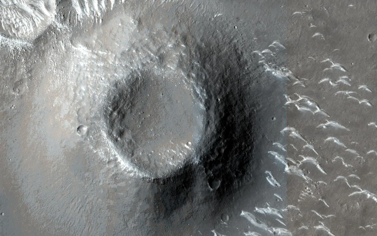
The Zhurong Rover Explores Utopia Planitia
Image: NASA/JPL-Caltech/University of Arizona · PIA24914 · NASA sourceOverview
The Zhurong rover landing site in southern Utopia Planitia represents China's groundbreaking entry into Mars surface exploration. Landing on May 14, 2021, at coordinates 25.07° N, 109.93° E, Zhurong has made remarkable discoveries about shallow subsurface ice deposits and ancient water activity in this region of Mars.
Using ground-penetrating radar and spectral analysis, Zhurong has revealed a complex subsurface structure with evidence of freeze-thaw cycles, buried polygonal terrain, and hydrated mineral deposits. These findings suggest that water activity persisted in Utopia Planitia much more recently than previously thought, with implications for both astrobiology and future resource utilization.
The rover's discoveries of potential ancient shoreline deposits and evidence of recent aqueous activities have revolutionized our understanding of Mars' climate evolution and the persistence of water at lower latitudes than previously documented.
Quick Facts
Zhurong Mission and Discoveries
The Zhurong rover, named after the Chinese god of fire, is part of China's ambitious Tianwen-1 Mars exploration mission. Equipped with advanced ground-penetrating radar, multispectral cameras, and magnetic field detectors, Zhurong has been investigating the morphology, mineralogy, and subsurface structure of southern Utopia Planitia.
Mission Objectives
- • Investigate surface morphology and geology
- • Study subsurface structure and water distribution
- • Analyze mineralogy and soil composition
- • Monitor space environment conditions
- • Search for signs of ancient life
- • Map potential resource locations
Scientific Instruments
- • Ground-penetrating radar system
- • Multispectral camera suite
- • Short-wave infrared spectrometer
- • Magnetic field detector
- • Climate monitoring station
- • Laser-induced breakdown spectroscopy
Subsurface Ice and Water Evidence
Polygonal Terrain Discovery
Zhurong's ground-penetrating radar detected 16 buried polygonal structures within its traverse path, located below 35 meters depth. These polygons are interpreted as evidence of repeated freeze-thaw cycles, indicating the presence of ground ice in the subsurface.
The widespread distribution of these features suggests that similar ice-related polygons may be common throughout Utopia Planitia, representing a significant water resource.
Hydrated Mineral Detection
Using short-wave infrared spectral analysis, Zhurong identified hydrated sulfate and silica materials associated with bright-toned rocks interpreted as duricrust. These formations suggest interaction with substantial liquid water.
The hydrated minerals indicate water activity that may have originated from groundwater rising or subsurface ice melting during recent climate fluctuations.
Multi-Layered Subsurface Structure
Zhurong's radar survey constructed a detailed subsurface profile revealing a roughly 70-meter-thick, multi-layered structure beneath the regolith. Two distinct fining-upward layers with similar vertical structures were identified, interpreted as sedimentary deposits formed during the advance and retreat of ancient water bodies.
This layered structure provides compelling evidence for episodic water activity and suggests that Utopia Planitia may have experienced multiple periods of aqueous conditions throughout its geological history.
Evidence of Recent Aqueous Activities
Duricrust Formation
Zhurong discovered lithified duricrusts formed by cementation processes requiring substantial liquid water. These formations suggest water activity that is much more recent than previously thought for this region of Mars.
The presence of these crusts indicates a more active Amazonian hydrosphere than previously understood, with implications for recent habitability conditions.
Ancient Shoreline Evidence
Recent analysis of the landing area has unveiled evidence for a probable ancient nearshore zone in southern Utopia Planitia, suggesting the region once hosted significant bodies of standing water.
Marine sedimentary rocks identified in the area provide additional support for extensive aqueous environments in Mars' geological past.
Water Source Mechanisms
Zhurong's findings suggest multiple potential sources for the water and ice required for freeze-thaw processes: cryogenic suction-induced moisture migration from underground aquifers, snowfall from the atmosphere, or vapor diffusion for pore ice deposition.
Higher obliquities during Mars' past could have stabilized ground ice at the Zhurong landing site for extended periods, with hydrated minerals and salt cementations implying the presence of briny liquid water generated by melting ground ice during temporary climate perturbations.
Geological Features and Context
The Zhurong landing site is characterized by diverse geological features within a 30-kilometer radius, including pitted cones, ghost craters, mesas, troughs, and ridges. These features are indicative of possible volatile presence in the shallow subsurface, supporting the rover's discoveries of ice-related processes.
Surface Features
- • Pitted cones
- • Ghost craters
- • Mesa formations
- • Linear troughs
- • Ridge systems
Volatile Indicators
- • Polygonal ground patterns
- • Periglacial features
- • Hydrated mineral deposits
- • Salt cementations
- • Frost indicators
Water Evidence
- • Sedimentary layering
- • Ancient shoreline deposits
- • Marine rock formations
- • Duricrust development
- • Aqueous alteration
Terraforming Assessment
High Terraforming Potential
Active exploration site with proven water resources
Advantages
- • Currently active exploration site
- • Shallow subsurface ice deposits
- • Evidence of recent water activity
- • Diverse geological features
- • Proven resource accessibility
- • Modern mission data available
- • Lower latitude location
Challenges
- • Deep ice extraction requirements
- • Dust accumulation issues
- • Temperature extremes
- • Radiation exposure concerns
- • Seasonal climate variations
- • Complex subsurface layering
Future Exploration Opportunities
The Zhurong landing site represents an ideal location for follow-up missions focused on subsurface resource characterization and water extraction technology development. The rover's ongoing discoveries continue to refine our understanding of water accessibility and distribution in this region.
Research Priorities
- • Deep subsurface ice characterization
- • Polygonal terrain detailed mapping
- • Hydrated mineral analysis
- • Ancient shoreline investigation
- • Water extraction feasibility studies
- • Climate history reconstruction
Mission Applications
- • International collaboration site
- • ISRU technology demonstrations
- • Subsurface drilling operations
- • Water resource utilization
- • Astrobiology investigations
- • Long-term monitoring stations