Valles Marineris (Central canyon)
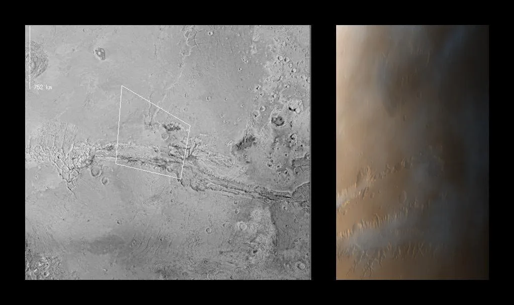
Valles Marineris
Image: NASA/JPL/Malin Space Science Systems · PIA00992 · NASA sourceOverview
Valles Marineris stands as one of the most spectacular geological features in our solar system - a vast canyon system that stretches over 4,000 kilometers (2,500 miles) across the Martian equatorial region. Named after the Mariner 9 spacecraft that first revealed its grandeur in 1971, this colossal rift system dwarfs Earth's Grand Canyon in every dimension.
The canyon system reaches depths of up to 7 kilometers (4.3 miles) and widths of up to 200 kilometers (120 miles), making it roughly 10 times longer, 20 times wider, and 5 times deeper than the Grand Canyon. If placed on Earth, Valles Marineris would stretch across the entire continental United States from New York to Los Angeles.
This massive tectonic feature provides an unparalleled window into Mars' geological history, exposing rock layers that span billions of years and offering compelling evidence of the planet's dynamic past, including periods of intense volcanic activity and the possible presence of ancient lakes.
Massive Scale
Major Canyon Sections
Western Region
Noctis Labyrinthus
The "Labyrinth of the Night" - a complex maze of intersecting valleys and canyons up to 10 km deep, formed by tectonic fracturing as the Tharsis bulge expanded.
- • Rectangular canyon patterns
- • Deepest sections of system
- • Complex fracture networks
Central Region
Main Chasmata
Including Ius, Tithonium, Melas, Candor, and Ophir Chasmata - parallel chasms 5-8 km deep that likely formed through rifting and tectonic processes.
- • Linear east-west orientation
- • Evidence of ancient lakes
- • Massive landslide deposits
Eastern Region
Outflow Channels
Ganges, Capri, and Eos Chasmata leading to chaotic terrain and outflow channels that drain toward Chryse Planitia in the northern plains.
- • Broad, shallow canyons
- • Chaotic terrain formations
- • Ancient flood channels
Formation and Geological History
Tectonic Origins
Most scientists agree that Valles Marineris formed primarily through tectonic processes related to the massive Tharsis volcanic region to the west. As this enormous volcanic bulge formed and grew over billions of years, it created tremendous stress on the Martian crust, leading to rifting and fracturing that carved out the initial canyon system.
Primary Formation Processes
- • Crustal rifting from Tharsis uplift
- • Graben formation and collapse
- • Tectonic stress fracturing
- • Possible magma withdrawal subsidence
Secondary Modification
- • Massive landslides and erosion
- • Ancient lake formation and drainage
- • Wind erosion and sediment transport
- • Seasonal frost and sublimation cycles
Evidence of Ancient Water
Multiple lines of evidence suggest that parts of Valles Marineris once contained substantial bodies of water, possibly including lakes that persisted for extended periods.
- • Layered sedimentary deposits in canyon floors
- • Mineral formations requiring liquid water
- • Delta-like features and terraces
- • Hydrated minerals in canyon walls
- • Outflow channel networks
Geological Exposures
The canyon walls expose an unprecedented cross-section of Martian crustal history, revealing layers of rock formed over billions of years.
- • Ancient crustal basement rocks
- • Volcanic flow sequences
- • Sedimentary layer formations
- • Impact breccia deposits
- • Sulfate and clay mineral deposits
Human Settlement Potential
With a terraforming rating of 7/10, Valles Marineris presents unique opportunities and challenges for human settlement. The canyon's location on the equator makes it one of the warmest regions on Mars, while its depth provides significantly higher atmospheric pressure than the surrounding highlands.
Unique Advantages
Environmental Benefits
- • Equatorial location for maximum solar energy
- • Higher atmospheric pressure at depth
- • Natural wind protection from canyon walls
- • Evidence of subsurface water/ice
- • Relatively stable temperatures
Resource Opportunities
- • Diverse mineral deposits in canyon walls
- • Potential water ice in shadowed areas
- • Natural building materials
- • Protected sites for infrastructure
- • Multiple microclimate zones
Atmospheric Advantage
The canyon floor experiences atmospheric pressure that is significantly higher than the rim - potentially 2-3 times greater at the deepest points. This increased pressure could make certain activities easier and provide better protection from radiation.
Settlement Challenges
- • Limited current water access
- • Dust accumulation and storms
- • Radiation exposure on canyon floor
- • Landslide and erosion risks
- • Communication difficulties from depth
- • Transportation and access challenges
- • Extreme elevation differences
Scientific Significance
Research Priorities
Valles Marineris represents one of the most scientifically valuable locations on Mars, offering insights into planetary formation, climate history, and the potential for past or present life. The canyon's vast exposures provide an unparalleled geological record.
Geological Studies
- • Crustal composition analysis
- • Volcanic history reconstruction
- • Tectonic process understanding
- • Impact event chronology
Climate Research
- • Ancient atmospheric conditions
- • Water cycle reconstruction
- • Climate change indicators
- • Seasonal process monitoring
Astrobiology
- • Ancient lake deposit analysis
- • Biosignature preservation potential
- • Hydrothermal activity evidence
- • Subsurface habitat assessment
Future Exploration Opportunities
Proposed Missions
- • Canyon Floor Rovers: Mobile laboratories to explore the diverse terrains and collect samples
- • Atmospheric Studies: Weather stations to monitor unique canyon climate conditions
- • Deep Drilling: Core samples from ancient lake deposits and layered formations
- • Human Reconnaissance: Crewed missions to assess settlement potential
Technology Demonstrations
- • Aerial Surveys: Helicopter or drone exploration of canyon sections
- • Habitat Testing: Prototype structures in protected canyon alcoves
- • Resource Utilization: Water extraction and processing demonstrations
- • Communication Networks: Relay systems for canyon-to-surface communications