Athabasca Valles
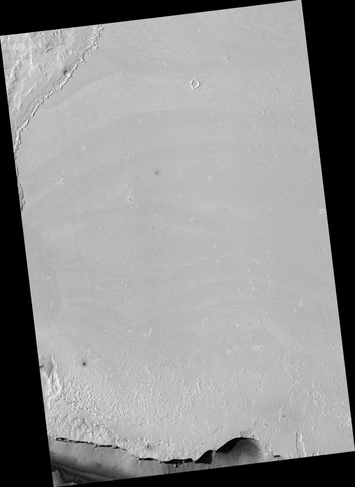
Flows in Athabasca Valles Source Region
Image: NASA/JPL/Univ. of Arizona · PIA09400 · NASA sourceOverview
Athabasca Valles represents one of Mars' most geologically young and extraordinary features - a flood-lava channel system that may have formed as recently as 20 million years ago. This remarkable outflow channel, stretching over 300 kilometers southeast of Elysium Mons, provides unique insights into Mars' recent geological activity and potential water-lava interactions.
What makes Athabasca Valles truly exceptional is its dual nature: originally carved by catastrophic water floods bursting from the Cerberus Fossae fractures, the channels were later completely draped by a massive lava flow. This lava unit is as large as Oregon and represents one of the largest flood lava provinces ever identified on Mars.
Recent 2024 research has revealed new evidence suggesting either more massive flooding events than previously thought, or climate conditions that allowed equatorial ice preservation - findings that revolutionize our understanding of Mars' recent geological and climate history.
Quick Facts
Dual Formation Process: Water Then Lava
Athabasca Valles tells a complex geological story involving two distinct catastrophic events separated by potentially millions of years. The channel system records both the most recent major flood event on Mars and one of its youngest volcanic eruptions.
Phase 1: Catastrophic Flooding
- • Water burst from Cerberus Fossae fractures
- • Groundwater trapped under ice layer released
- • Flow rates: 10,000-10 million m³/second
- • Carved distinctive channel morphology
- • Evidence of turbulent water flow patterns
Phase 2: Lava Inundation
- • Massive lava flow from same fissure system
- • Completely draped existing channels
- • Created Oregon-sized lava province
- • Preserved underlying flood morphology
- • Evidence of lava-ice interactions
Groundbreaking 2024 Research Findings
Climate vs. Flood Volume Paradox
New 2024 USGS research reveals that floods with previously estimated volumes cannot reach the distal rootless cones or Lethe Vallis. This finding suggests either Mars had a climate allowing equatorial ice preservation, or flood events were orders of magnitude larger than previously calculated.
This discovery challenges our understanding of both Mars' recent climate history and the scale of its most recent geological catastrophes.
Volcanic Rootless Cones Evidence
Rootless cones scattered across the lava flow indicate water was present in the shallow subsurface when volcanic activity occurred. These formations provide direct evidence of lava-water interactions and suggest water persisted in the region between the flood and volcanic events.
The distribution pattern of these cones helps scientists understand the extent and timing of subsurface water availability.
Turbulent Lava Flow Analysis
High-resolution imaging has revealed that the Athabasca Valles flood lava displays unique morphological evidence of turbulent flow - the only confirmed instance of such behavior in Martian lava flows. This turbulent signature suggests extremely high effusion rates and provides insights into the volcanic processes that created this massive lava province.
The preserved flow patterns indicate this was not a typical basaltic eruption but rather a catastrophic volcanic event comparable to Earth's largest flood basalt provinces.
Lava-Ice Interactions and Implications
The interaction between lava flows and subsurface ice at Athabasca Valles provides crucial insights into Mars' hydrological processes and recent climate conditions. Recent studies suggest that large-scale lava-ice interactions may have been responsible for both the formation of the outflow channels and subsequent volcanic features.
Meltwater Confinement Model
Alternative formation theories propose that lava-ice interactions created confined meltwater systems that accumulated and catastrophically released, potentially explaining the channel formation without requiring deep groundwater sources.
Subsurface Ice Evidence
The presence of rootless cones indicates substantial subsurface ice was available during lava emplacement, supporting theories of recent ice preservation near Mars' equator.
Formation Timeline
Terraforming Assessment
Moderate Terraforming Potential
Recent geological activity with water-lava interactions
Advantages
- • Evidence of recent subsurface water
- • Young, geologically active terrain
- • Volcanic resources and energy potential
- • Large, flat lava plains for construction
- • Potential geothermal activity
- • Well-preserved geological record
Challenges
- • Ongoing volcanic hazard potential
- • Limited current surface water access
- • Extreme flood risk from future events
- • Dust accumulation issues
- • Radiation exposure on open plains
- • Seismic instability from Cerberus Fossae
Scientific Significance
Mars Climate Evolution
Athabasca Valles provides the youngest and most complete record of major geological activity on Mars. The evidence of recent water-lava interactions challenges conventional models of Mars' transition to its current cold, dry state and suggests more complex climate evolution than previously thought.
Comparative Planetology
As the only confirmed example of turbulent flood lava on Mars, Athabasca Valles provides crucial data for understanding volcanic processes on other planets. The scale and characteristics of this lava province exceed many comparable features on Earth, offering insights into planetary-scale volcanic processes.
Future Exploration Potential
As Mars' youngest major geological feature, Athabasca Valles represents a unique opportunity to study recent planetary processes and potential ongoing activity. The region's geological youth and preserved features make it an ideal target for understanding Mars' transition from ancient water activity to its current state.
Research Priorities
- • Subsurface ice detection and mapping
- • Volcanic hazard assessment
- • Detailed chronology of water-lava events
- • Rootless cone formation mechanisms
- • Climate modeling validation
Exploration Methods
- • Ground-penetrating radar surveys
- • Seismic monitoring networks
- • Sample collection from lava flows
- • Thermal imaging of fracture systems
- • Long-term geological monitoring